


)


Hurricane Beryl is breaking records as a major hurricane moving through the Caribbean. What should Texans be paying attention to?
DALLAS — Hurricane Beryl is already making history.
Here are the records so far:
- Earliest Category 5 hurricane in a calendar year (on record)
- Strongest hurricane in June in the Atlantic Basin (on record)
- Strongest hurricane in July in the Atlantic Basin (on record)
- The first major hurricane east of the Antilles in June
- Tropical storm to a major hurricane in 42 hrs. (has only happened 6 other times)
So where does the storm go from here? And will it have any impacts on Texas as it enters the Gulf of Mexico? Here’s the latest forecast and radar:

Hurricane Beryl live radar and tracker
Current status
As of 10 p.m. Tuesday evening, Beryl is still a Category 4 hurricane with winds of 150mph. It is currently south of Haiti/Dominican Republic and moving toward Jamaica.
Hurricane Watches are now in effect for the Yucatan Peninsula of Mexico.

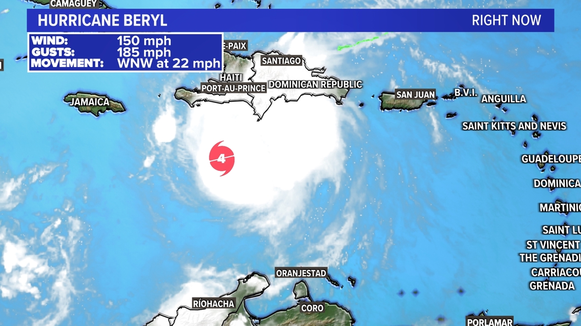


Where did Beryl make landfall?
It made landfall on Carriacou Island (Grenada) Monday morning as a Category 4 hurricane with 150 mph wind.
Hurricane Beryl’s current forecast track
The current forecast track for Beryl has it moving through the warm Caribbean waters through this week. Hurricane Warnings are active in Jamaica and the Cayman Islands for wind, rain, and storm surge.
It will pass very close to Jamaica and possibly could make another landfall on the island.
Beryl will weaken as it moves towards the Yucatan Peninsula, but still likely staying a hurricane. It makes it to the Peninsula late Thursday into early Friday. This will impact areas like Tulum to Cozumel to Cancun on Thursday into Friday. The current forecast track then has it moving into the southwestern Gulf as a Tropical Storm over the weekend.


Will Hurricane Beryl impact Texas?
As of now, Beryl will enter the Gulf of Mexico this weekend. Where it heads after that is still uncertain. A landfall from the coast of Mexico to South Texas is in play.
But what does look fairly certain is the storm will NOT be nearly as strong at that point as it has been in the Caribbean. However, it still could be a strong tropical storm or hurricane.
The ridge of high pressure that is bringing on the heat and rain-free days for Texas as well as a trough of low pressure that will bring rain chances and cooler temps to Texas this weekend will influence the eventual track of Beryl. We most likely won’t have a good idea of where it will make landfall in Mexico or Texas until the storm enters the Gulf this weekend.
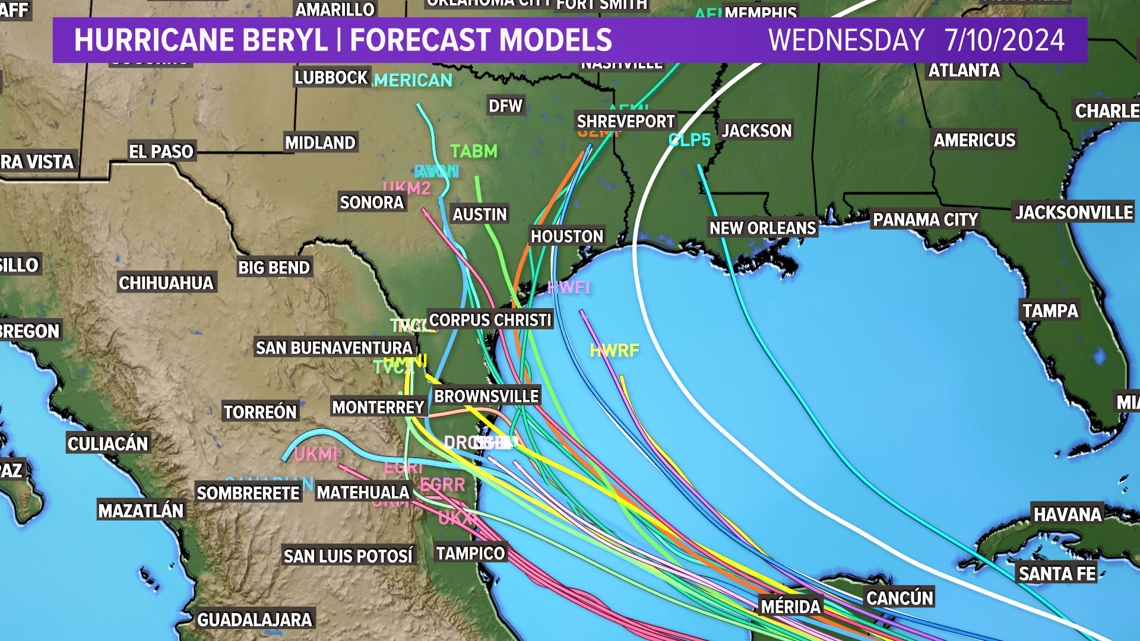
Hurricane Beryl spaghetti models
Each line represents a different model. Most are in agreement on impact for the Yucatan Peninsula, but differ once it moves into the Gulf.


