.jpg "Reframing Maternal Care to Combat Low Birth Weight")


A PDS (Particularly Dangerous Situation) thunderstorm warning has been issued in parts of Texas as parts of the state brace for destructive winds in the late evening.
Fast Facts:
- Potential derecho could develop in portions of Texas and Oklahoma.
- Destructive storms with 80-100 mph wind gusts and up to 5-inch hail expected in the southern Plains.
- Tornadoes may be embedded within the main line of storms.
Dallas – Millions of people in Texas and Oklaholaincluding the Dallas–Fort Worth Metroplex, will need to be on alert as the southern Plains braces for powerful storms packing destructive, Hurricane-force wind gusts, massive hail and even some tornadoes.

In a recent update, the NOAA‘s Storm Prediction Center (SPC) noted on Sunday that there could be a “right potentially developing into this evening and overnight, especially across much of North Texas and southern Oklahoma.”
The SPC issued a Particularly Dangerous Situation Severe Thunderstorm (PDS) Watch for western and central Kansas, northwest Oklahoma and the Texas Panhandle. The NWS warns widespread damaging winds with gusts of up to 90 mph are possible.
A PDS Severe Thunderstorm Watch is extremely rare, according to the FOX Forecast Center. The NWS has only issued these severe warnings 25 times since 2006.
The area is under a severe thunderstorm until the end of Sunday night and a flood watch until Monday morning.
The renewed threat comes after deadly storms barreled across portions of Mississippi and Georgiaand an apparent tornado left a trail of damage across McAlesterOklahoma, on Saturday.
-

Apparent tornado damage in McAlester, Oklahoma, on June 7, 2025.
(Derrick James / @dljames0001 / X) -

Apparent tornado damage in McAlester, Oklahoma, on June 7, 2025.
(Derrick James / @dljames0001 / X) -

Apparent tornado damage in McAlester, Oklahoma, on June 7, 2025.
(Derrick James / @dljames0001 / X) -

Apparent tornado damage in McAlester, Oklahoma, on June 7, 2025.
(Derrick James / @dljames0001 / X) -

Apparent tornado damage in McAlester, Oklahoma, on June 7, 2025.
(Derrick James / @dljames0001 / X) -

Apparent tornado damage in McAlester, Oklahoma, on June 7, 2025.
(Derrick James / @dljames0001 / X) -

Apparent tornado damage in McAlester, Oklahoma, on June 7, 2025.
(Derrick James / @dljames0001 / X)
The SPC upgraded the severe weather threat in portions of the south-central U.S. to a Level 4 risk on its 5-point severe thunderstorm risk scale.
DOWNLOAD THE FREE FOX WEATHER APP

(FOX Weather)
This upgraded threat includes nearly 7.5 million people in cities like Dallas, Fort Worth, Arlington, Plano and Garland in Texas.
More than 4 million people in cities like Ololama City and Norman in Oklahoma, as well as Lubbock, Yellow and Abilene in Texas are in a Level 3 out of 5 risk.
WATCH VS. WARNING: HERE ARE THE DIFFERENCES BETWEEN THESE WEATHER TERMS THAT COULD SAVE YOUR LIFE

(FOX Weather)
The FOX Forecast Center said that while there is a tornado threat, the bigger threat will be destructive wind gusts between 80 and 100 mph within the main line of the storms. That’s because strong winds aloft in the mid-levels of the atmosphere will exist.
A pocket of cooler air will also be in place, which will then help some of the significant wind gusts reach the surface. The dense, cooler air, along with torrential rain, will serve as the pathway for the winds to work toward the ground.
HOW PUBLIC SAFETY OFFICIALS NOTIFY YOU DURING SEVERE WEATHER EMERGENCIES

Hail size representation.
(FOX Weather)
In addition, the SPC said that hail up to 5 inches, which is larger than a grapefruitis also possible.
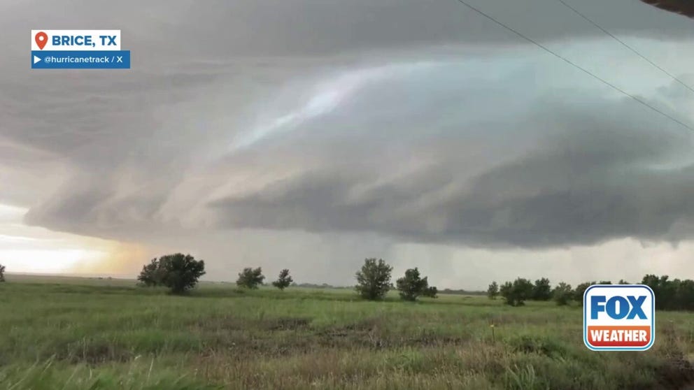
Supercell thunderstorms are likely in Oklahoma and Texas, and the wide coverage of storms will then eventually form into a potentially intense mesoscale convective system (MCS).