Announces The Spotlight Lineup")


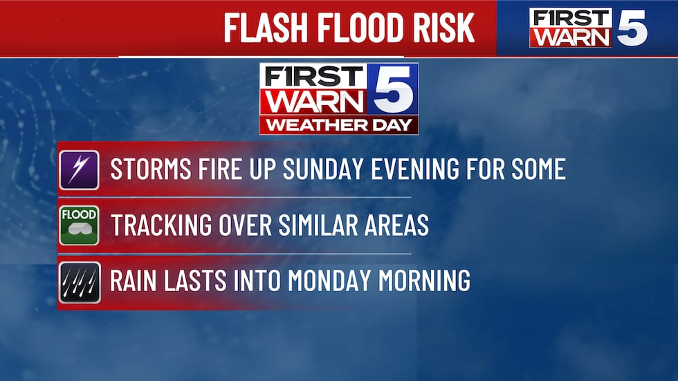
KANSAS CITY, Mo. (KCTV) – Storms continue to grow in coverage late Sunday evening, mainly near and south of I-70. The heightened concern for pockets of flash flooding still is present. The main reason for the flash flooding concern is that we could see thunderstorms fire up and continually track over the same area. This poses a risk for excessive rainfall in a short amount of time.

Storms continue to grow in coverage late Sunday evening, mainly near and south of I-70. The heightened concern for pockets of flash flooding still is present. The main reason for the flash flooding concern is that we could see thunderstorms fire up and continually track over the same area. This poses a risk for excessive rainfall in a short amount of time.

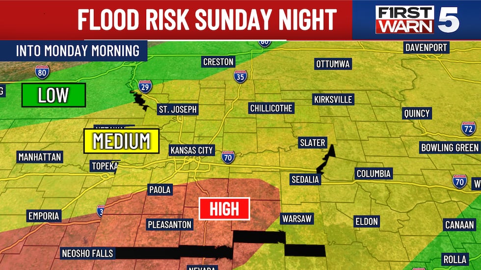
The coverage on radar does become a bit more widespread into the early overnight. There will be a steep cutoff with rainfall totals. Some of you have the potential for an additional 1 to 3+ inches of rain, while others only might get a few tenths of an inch.
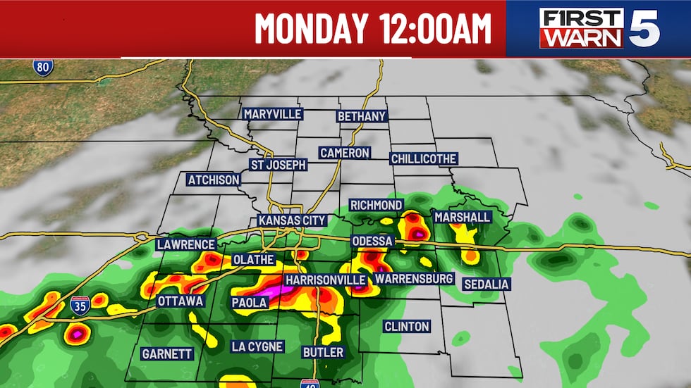
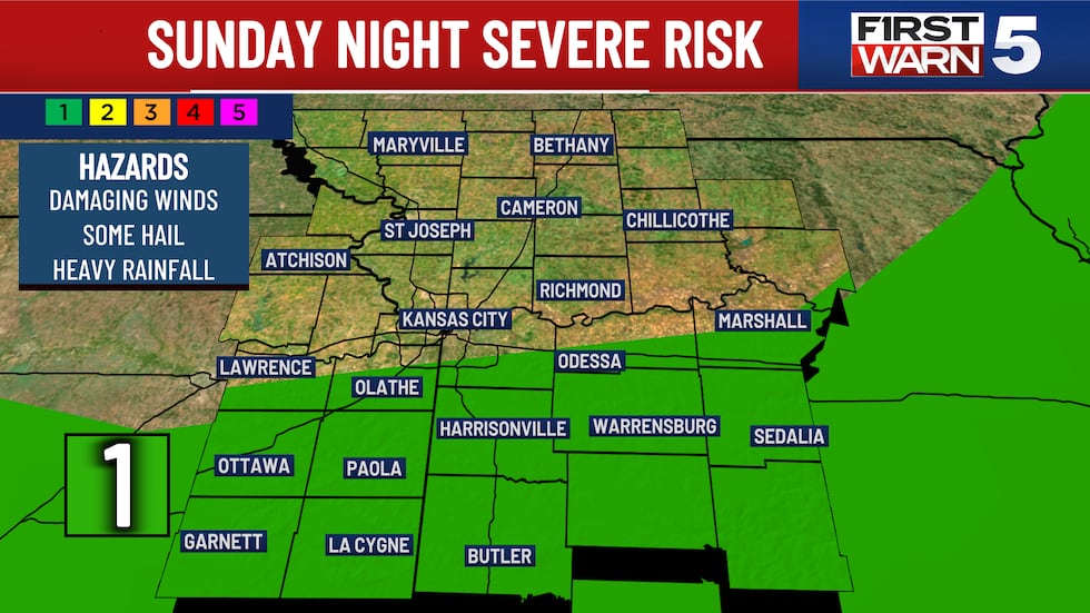
It is a waiting game at this point to see how far south the storms form. An isolated strong to severe storm will be possible with a level 1/5 risk south of I-70. Gusty winds are the primary concern if a cell becomes strong.
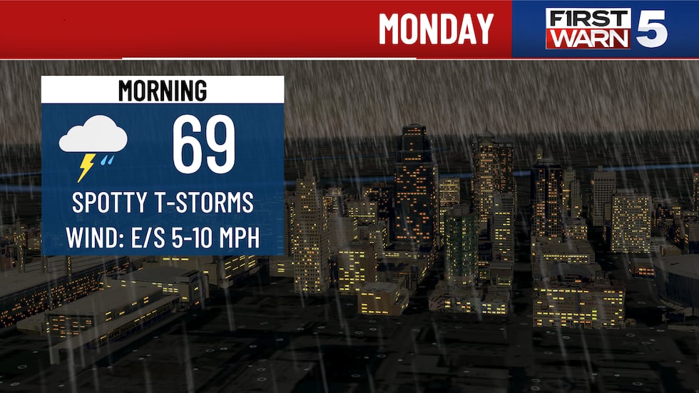
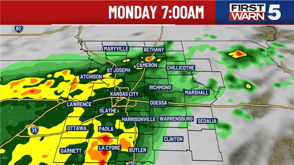
We will see a larger area of rain form into Monday morning, but the threat for flash flooding should start to fall off. There still could be impacts to the morning commute with a light to moderate steady rain falling. Those of you with school districts starting tomorrow could have a damp start to the day. This looks to be a larger area covered, so those of you north of I-70 will still have a rain chance, but it’s more into Monday morning. Then, dry hours are expected midday and afternoon.
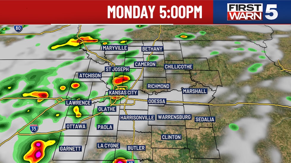
The latest computer guidance wants to try and fire up a few storms in the afternoon, so we will watch for that as well. The rain and cloud coverage on Monday is going to keep high temperatures in the lower 80s.
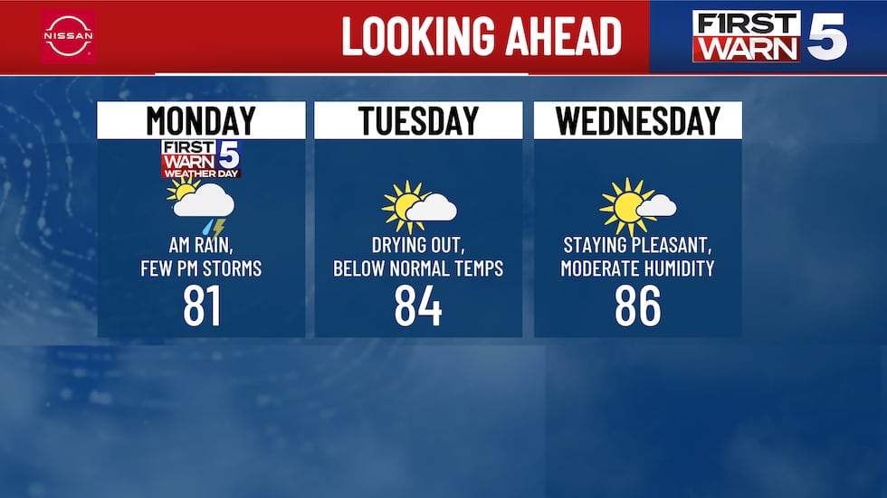
The rest of the week looks drier. Afternoon high temperatures will slowly climb through the 80s through Thursday. Lower 90s are expected Friday and into this next weekend. Humidity levels are going to climb a bit as well.
Copyright 2025 KCTV. All rights reserved.