")


 could return this month")


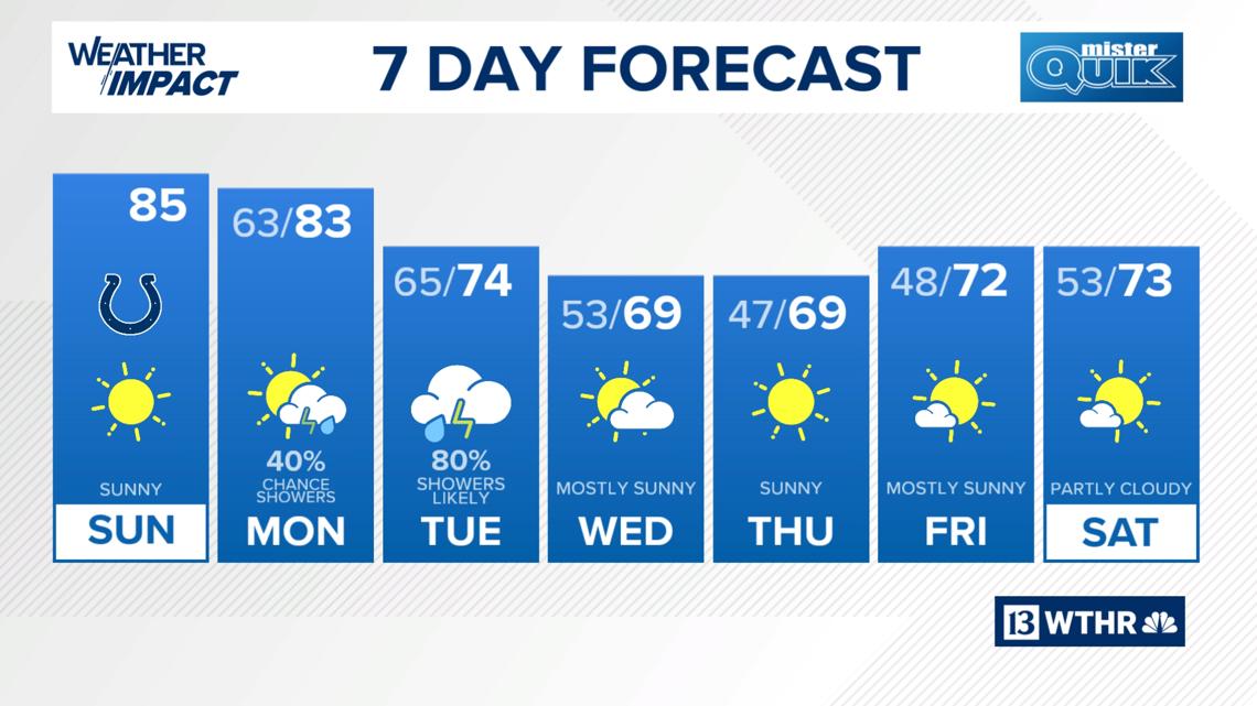
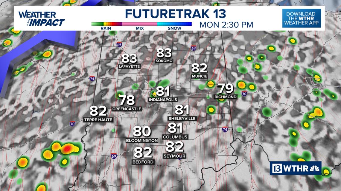
Our stretch of 80 degree days is about to wrap-up as a cold front brings rain chances to central Indiana starting Monday afternoon.
INDIANAPOLIS — Our stretch of 80 degrees days is about to wrap-up as a cold front brings rain chances to central Indiana starting Monday afternoon with more seasonal temperatures returning by Tuesday.

TODAY
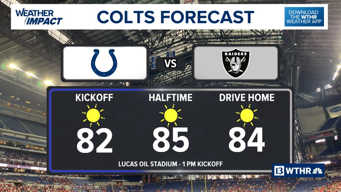
It’ll be a sunny and warm morning in Touchdown Town for Colts tailgaters. The roof and window will be closed today at Lucas Oil Stadium. Temperatures will again recover into the mid 80s in the afternoon, nearly 15 degrees above average for this time of year. You may notice a brisk wind at times with gusts from the south up to 20 mph.

TONIGHT
SUNSET: 7:20 p.m. EDT
The sky remains clear this evening and overnight as temperatures drop into the low 60s.
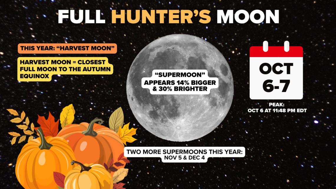
Even though October’s full Moon will peak just before midnight late Monday evening, we’ll have clouds and rain in the area so you’ll want to take advantage of the clear sky tonight to check out.
This will be a special full Moon as it will be the first of three consecutive “supermoons.” A supermoon occurs when the Moon is full when it is at its closest point to Earth on its orbit known as the “perigee.” The Moon may seem 14% bigger and 30% brighter. October’s full Moon is also known as the Hunter’s Moon, and this year, the Harvest Moon. The Harvest Moon is the name given to the closest full Moon to the autumn equinox.

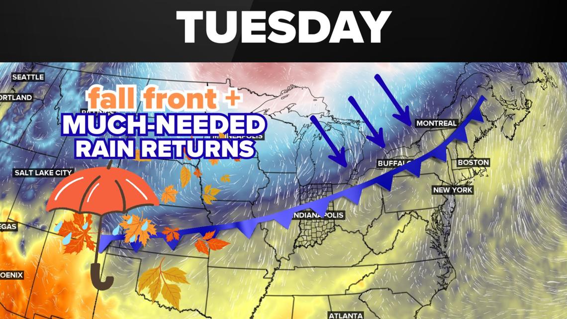
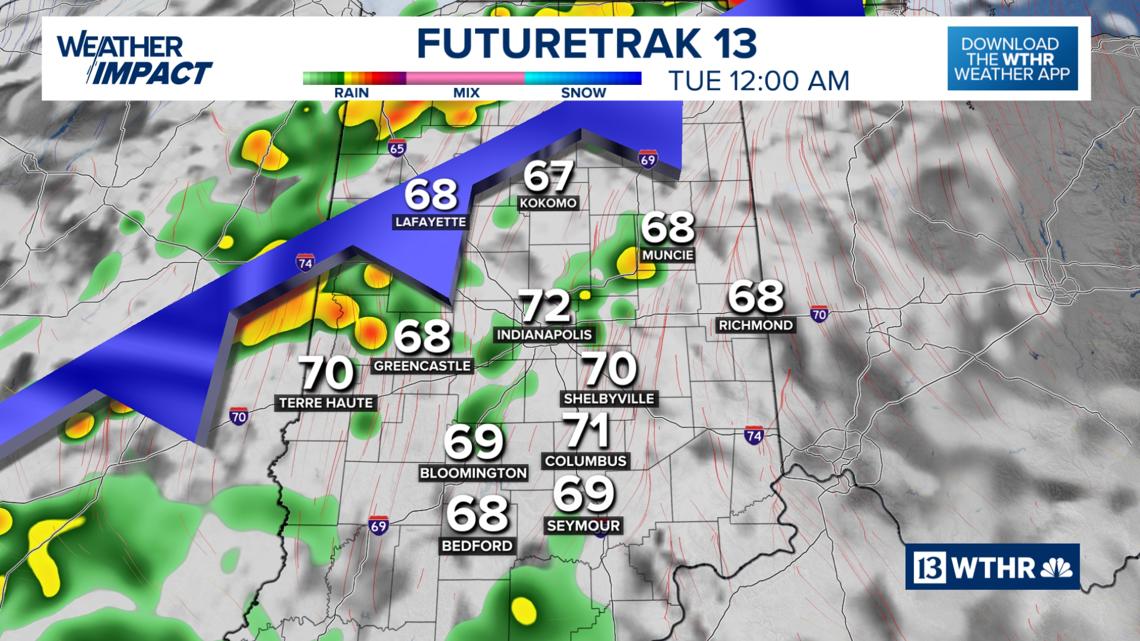
Much-needed rain returns late Monday, Tuesday
Ahead of the cold front arriving, it’ll be a dry start to the day on Monday with temperatures recovering into the low to mid 80s. Stray showers and storms are possible out ahead of the main frontal boundary in the late afternoon and evening.

The more widespread rain arrives overnight Monday into Tuesday morning into the early afternoon.


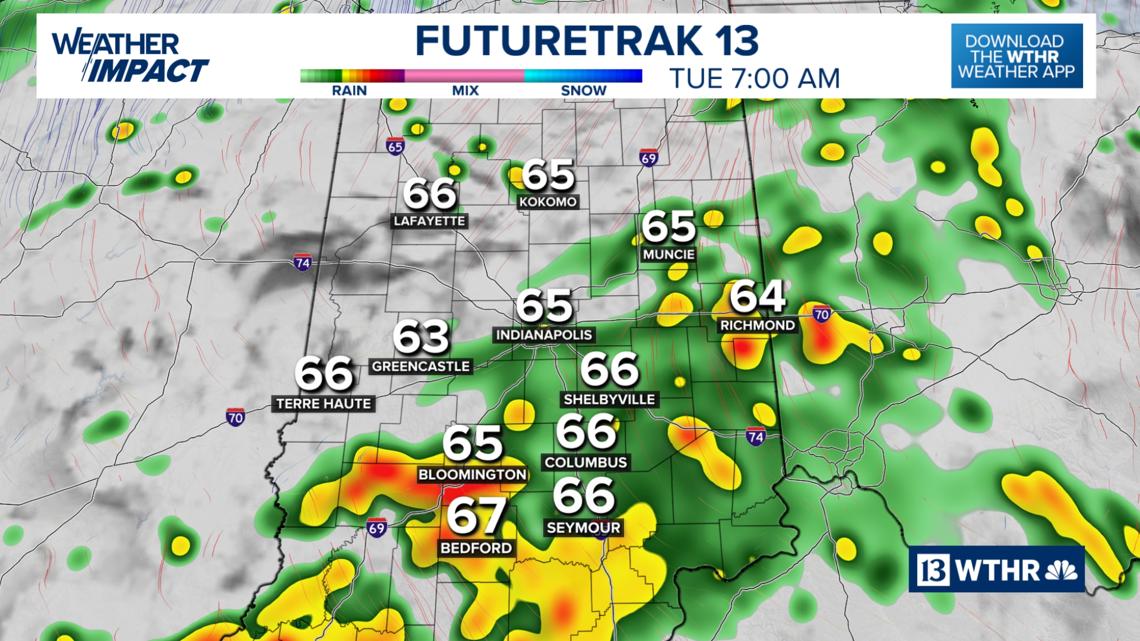

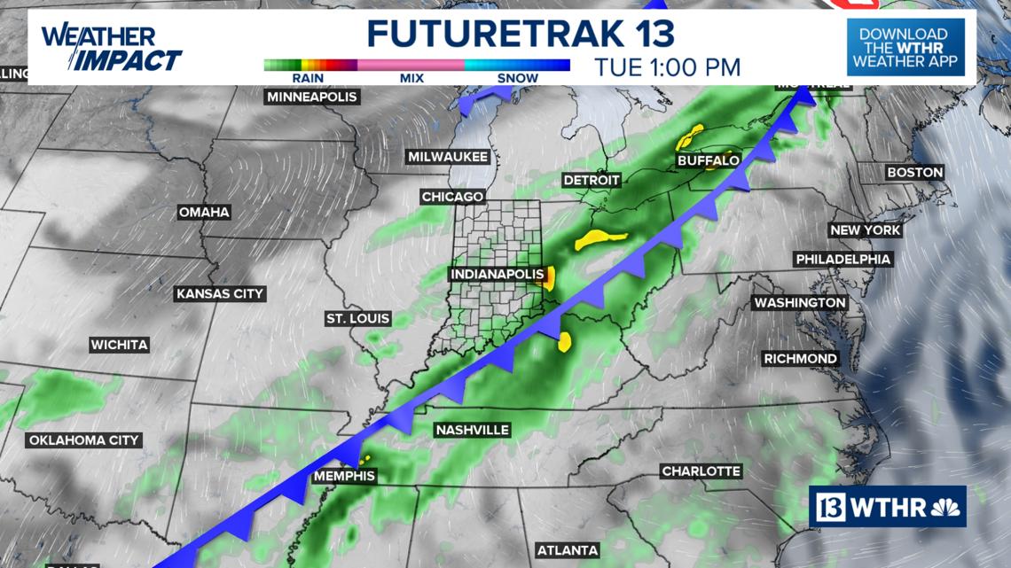
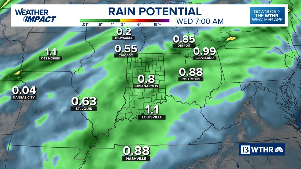
Showers will push south by Tuesday night with a clearing sky by Wednesday morning. Most of the area sees around a half inch of rain, but isolated areas may see up to 0.75″.

Finally feeling like fall
Temperatures will become more seasonal on Tuesday with the rain and clouds and highs in the mid 70s. With a clearing sky and cooler air mass settling in on Wednesday, temperatures will be noticeably cooler with highs in the upper 60s (Thursday too). Temperatures will then start to recover back through the 70s starting Friday and into next weekend.